Image:Lake District Map.PNG
From Wikipedia, the free encyclopedia
- Image
- File history
- File links
No higher resolution available.
Lake_District_Map.PNG (514 × 599 pixel, file size: 8 KB, MIME type: image/png)
|
|
This is a file from the Wikimedia Commons. The description on its description page there is shown below. |
|
|
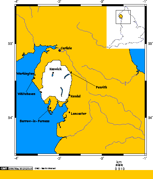
The location of the Lake District, shown in white, within Cumbria, northern England
Map created by Robdurbar, composite from others
 |
Robdurbar on the English Wikipedia project has granted permission to copy, distribute and/or modify this document under the terms of the GNU Free Documentation License, Version 1.2 or any later version published by the Free Software Foundation; with no Invariant Sections, no Front-Cover Texts, and no Back-Cover Texts. A copy of the license is included in the section entitled " GNU Free Documentation License." Subject to disclaimers. |
File links
The following pages on the English Wikipedia link to this file (pages on other projects are not listed):