Image:1855 PRR.jpg
From Wikipedia, the free encyclopedia
- Image
- File history
- File links
Size of this preview: 800 × 100 pixel
Image in higher resolution (21344 × 2656 pixel, file size: 11.73 MB, MIME type: image/jpeg)
|
|
This is a file from the Wikimedia Commons. The description on its description page there is shown below. |
|
|
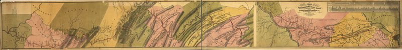
1855 map of the Pennsylvania Railroad from .
 |
This map is available from the United States Library of Congress under the digital ID g3821p.rr005170 This tag does not indicate the copyright status of the attached work. A normal copyright tag is still required. See Commons:Licensing for more information. |
 |
This image (or other media file) is in the public domain because its copyright has expired. This applies to the United States, Canada, the European Union and those countries with a copyright term of life of the author plus 70 years. العربية ǀ Български ǀ Català ǀ Česky ǀ Dansk ǀ Deutsch ǀ English ǀ Ελληνικά ǀ Esperanto ǀ Español ǀ Euskara ǀ فارسی ǀ Français ǀ Galego ǀ עברית ǀ हिन्दी ǀ Bahasa Indonesia ǀ Italiano ǀ 日本語 ǀ 한국어 ǀ Kurdî / كوردي ǀ Nederlands ǀ Norsk (nynorsk) ǀ Bahasa Melayu ǀ Polski ǀ Português ǀ Русский ǀ Slovenščina ǀ Shqip ǀ Suomi ǀ Svenska ǀ Türkçe ǀ 简体中文 ǀ 正體中文 ǀ +/- |
File links
The following pages on the English Wikipedia link to this file (pages on other projects are not listed):
- Transportation in Lancaster County, Pennsylvania