Image:DC locator map with state names w usmap.png
From Wikipedia, the free encyclopedia
No higher resolution available.
DC_locator_map_with_state_names_w_usmap.png (252 × 196 pixel, file size: 62 KB, MIME type: image/png)
Summary
Licensing
|
|
This image is licensed under the Creative Commons Attribution ShareAlike License v. 2.5: http://creativecommons.org/licenses/by-sa/2.5/ |
File history
Legend: (cur) = this is the current file, (del) = delete this old version, (rev) = revert to this old version.
Click on date to download the file or see the image uploaded on that date.
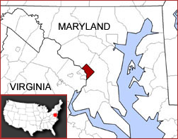
- (del) (cur) 19:13, 7 January 2006 . . Aude ( Talk | contribs) . . 252×196 (63,487 bytes) (Washington, D.C. locator map, showing the location within the Maryland/Virginia region (w/ US inset map). Map combines Image:Map_of_usa_highlighting_dc.png and Image:DC_locator_map_with_state_names.jpg Created by Kmf164, with c)
-
Edit this file using an external application
See the setup instructions for more information.
File links
The following pages on the English Wikipedia link to this file (pages on other projects are not listed):
- Wikipedia talk:WikiProject Countries
- Washington, D.C.
- Image:DC locator map with state names w usmap.png
- Talk:Washington, D.C./Archive 2
Category: Creative Commons Attribution-ShareAlike 2.5 images