Image:LocationBahamas.png
From Wikipedia, the free encyclopedia
- Image
- File history
- File links
LocationBahamas.png (250 × 115 pixel, file size: 5 KB, MIME type: image/png)
|
|
This is a file from the Wikimedia Commons. The description on its description page there is shown below. |
|
|
 |
|
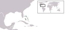
Location map for the Bahamas.
Originally created for English Wikipedia by Vardion.
|
|
This image has been (or is hereby) released into the public domain by its author, Vardion at the English Wikipedia project. This applies worldwide. In case this is not legally possible: |
 A vector version of this image ("SVG") is available. For more information about vector graphics, read about Commons transition to SVG. English | Français | Polski | +/- |
 |
File links
- User:DanielZM/test
- User talk:UmptanumRedux/UmptanumRedux1
- User:TheGrappler/North America directory
Categories: Public domain images | Country locator maps | Images of Bahamas | Maps of the Bahamas