Nile
2007 Schools Wikipedia Selection. Related subjects: African Geography
| Nile | |
|---|---|
|
|
|
| Origin | Africa |
| Mouth | Mediterranean Sea |
| Basin countries | Sudan, Burundi, Rwanda, DR Congo, Tanzania, Kenya, Uganda, Ethiopia, Egypt |
| Length | 6,695 km (4,160 mi) |
| Source elevation | 1,134 m (3,721 ft) |
| Avg. discharge | 2,830 m³/s (99,956 ft³/s) |
| Basin area | 3,400,000 km² (1,312,740 mi²) |
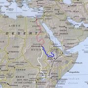
The Nile (Arabic: النيل, translit: an-nīl, Ancient Egyptian iteru) is a major north-flowing river in Africa, generally regarded as the longest river on Earth, though some sources claim the Amazon in South America is longer. The Nile has two major tributaries, the White Nile and Blue Nile, the latter being the source of most of the Nile's water and fertile soil, but the former being the longer of the two. The White Nile rises in the Great Lakes region of central Africa, with the most distant source in southern Rwanda , and flows north from there through Tanzania, Lake Victoria, Uganda and southern Sudan, while the Blue Nile starts at Lake Tana in Ethiopia, flowing into Sudan from the southeast. The two rivers meet near the Sudanese capital Khartoum.
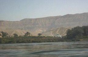
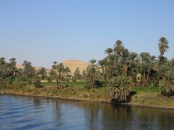
The northern section of the river flows almost entirely through desert, from Sudan into Egypt, a country whose civilization has depended on the river since ancient times. Most of the population of Egypt and all of its cities, with the exception of those near the coast, lie along those parts of the Nile valley north of Aswan; and nearly all the cultural and historical sites of Ancient Egypt are found along the banks of the river.
The Nile ends in a large delta that empties into the Mediterranean Sea.
Etymology of the word Nile
The word "Nile" (Arab. 'nīl) comes from the Greek word Neilos (Νειλος), meaning river valley. The ancient Egyptians called the Nile iteru, meaning "big river", represented by the hieroglyphs shown on the right (literally itrw).
Tributaries
The drainage basin of the Nile covers 3,254,555 km², about 10% of the area of Africa .
There are two great Tributaries of the Nile: the White Nile, beginning in equatorial East Africa, and the Blue Nile, beginning in Ethiopia. Both branches are on the western flanks of the East African Rift, the southern part of the Great Rift Valley. Another less important one is Atbara which flows only while there is rain in Ethiopia and dries very fast.
White Nile
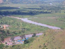
The source of the Nile is sometimes considered to be Lake Victoria, but the lake itself has feeder rivers of considerable size. The most distant stream emerges from Nyungwe Forest in Rwanda, via the Rukarara, Mwogo, Nyabarongo and Kagera rivers, before flowing into Lake Victoria in Tanzania near the town of Bukoba.
The Nile leaves Lake Victoria at Ripon Falls, near Jinga, Uganda, as the Victoria Nile. It flows for approximately 500 km (300 miles) farther, through Lake Kyoga, until it reaches Lake Albert. After leaving Lake Albert, the river is known as the Albert Nile. It then flows into Sudan, where it becomes known as the Bahr al Jabal ("River of the Mountain"). At the confluence of the Bahr al Jabal with the Bahr al Ghazal, itself 720 km (445 miles) long, the river becomes known as the Bahr al Abyad, or the White Nile, from the white-ish clay suspended in its waters. From there, the river flows to Khartoum.
Blue Nile
The Blue Nile ( Ge'ez ጥቁር ዓባይ Ṭiqūr ʿĀbbāy (Black Abay) to Ethiopians; Bahr al Azraq to Sudanese) springs from Lake Tana in the Ethiopian Highlands. The Blue Nile flows about 1,400 km (850 miles) to Khartoum, where the Blue Nile and White Nile join to form the "Nile proper". 90% of the water and 96% of the transported sediment carried by the Nile originates in Ethiopia, but this runoff happens only in summer, when the great rains fall on the Ethiopian Plateau; the rest of the year, the great rivers draining Ethiopia into the Nile (Sobat, Blue Nile, and Atbarah) flow weakly.
Hydrology
The flow rate of the Albert Nile at Mongalla is almost constant throughout the year and averages 1048 cubic meters per second. After Mongalla the Nile is known as the Bahr El Jebel which enters the enormous swamps of the Sud region of the Sudan. More than half of the Nile’s water is lost in this swamp to evaporation and transpiration. The average flow rate in the Bahr El Jebel at the tails of the swamps is about 510 cubic meters per second. From here it soon meets with the Sobat River and forms the White Nile.
The average flow of the White Nile at Malakal is 924 cubic meters per second, the peak flow is approximately 1218 cubic meters per seconds in early March and minimum flow is about 609 cubic meters per seconds in late August. The fluctuation here is due the substantial variation in the flow of the Sobat which has a minimum flow of about 99 cubic meters per seconds in august and a peak flow of over 680 cubic meters per seconds in early March.
From here the White Nile flows to Khartoum where it merges with the Blue Nile to form the Nile River. Further up stream the Atbara River, the last significant Nile tributary, merges with the Nile.
The White Nile contributes approximately 31% of the yearly Nile discharge. However during the dry season (January to June) the White Nile contributes between 70% and 90% of the total discharge from the Nile. During this period of time the natural discharge of the Blue Nile can be as low as 113 cubic meters per seconds, although upstream dams regulate the flow of the river. During the dry period the flow of the Atbara River will typically be zero.
The Blue Nile contributes approximately 80-90% of the Nile River discharge. The flow of the Blue Nile varies considerably over its yearly cycle and is the main contribution to the large natural variation of the Nile flow. During the wet season the peak flow of the Blue Nile will often exceed 5663 cubic meters per seconds in latter August (variation by a factor of 50).
Before the placement of dams on the river the yearly discharge varied by a factor of 15 at Aswan. Peak flows of over 8212 cubic meters per seconds would occur during the later portions of August and early September and minimum flows of about 552 cubic meters per seconds would occur during later April and early May.
The Nile basin is complex and because of this the discharge at any given point along the river depends on many factors including weather, diversions, evaporation/evapotranspiration, and ground water flow.
In 1958 radioisotope tracking led to the discovery of a subterranean river, also called a crypto-river, which flows beneath the Nile. The flow of this river is very large; estimates place the annual discharge in the range of 566 cubic km. This is equivalent to an average flow rate of almost 18,000 cubic metres per second. The discharge of this crypto-river is approximately six times the annual discharge of the Nile.
Distributaries or branches
After the Blue and White Niles merge, the only remaining major tributary is the Atbara River, which originates in Ethiopia north of Lake Tana, and is approximately 800 km (500 miles) long. It joins the Nile approximately 300 km (200 miles) past Khartoum. The Nile is also unusual in that its last tributary (the Atbara) joins it approximately halfway to the sea. From that point north, the Nile diminishes because of evaporation.
The Nile in Sudan is distinctive for two reasons: 1) it flows over 6 groups of cataracts, from the first at Aswan to the sixth at Sabaloka (just north of Khartoum); and 2) it reverses direction for much of its course, flowing back toward the southwest before returning to flow north again to the sea. This is called the `"Great Bend of the Nile."'
The Nile splits into two branches (or distributaries), the Rosetta Branch to the west and the Damietta to the east, North of Cairo, forming the Nile Delta
History
The Nile (iteru in Ancient Egyptian) was the lifeline of the ancient Egyptian civilization, with most of the population and all of the cities of Egypt resting along those parts of the Nile valley lying north of Aswan. The Nile has been the lifeline for Egyptian culture since the Stone Age. Climate change, or perhaps overgrazing, desiccated the pastoral lands of Egypt to form the Sahara desert, possibly as long ago as 8000 BC, and the inhabitants then presumably migrated to the river, where they developed a settled agricultural economy and a more centralized society.
Role in the founding of Egyptian civilization
Sustenance played a crucial role in the founding of Egyptian civilization. The Nile was an unending source of sustenance. The Nile made the land surrounding it extremely fertile when it flooded or was inundated annually. The Egyptians were able to cultivate wheat and crops around the Nile, providing food for the general population. Also, the Nile’s water attracted game such as water buffalo; and after the Persians introduced them in the 7th century BC, camels. These animals could be killed for meat, or could be captured, tamed and used for ploughing — or in the camels' case, travelling. Water was vital to both people and livestock. The Nile was also a convenient and efficient way of transportation for people and goods.
Egypt’s stability was one of the best structured in history. In fact, it might easily have surpassed many modern societies. This stability was an immediate result of the Nile’s fertility. The Nile also provided flax for trade. Wheat was also traded, a crucial crop in the Middle East where famine was very common. This trading system secured the diplomatic relationship Egypt had with other countries, and often contributed to Egypt's economic stability. Also, the Nile provided the resources such as food or money, to quickly and efficiently raise an army. Whether the army was to take on a defensive or offensive role is unknown.
The Nile played a major role in politics and social life. The Pharaoh would supposedly flood the Nile, and in return for the life-giving water and crops, the peasants would cultivate the fertile soil and send a portion of the resources they had reaped to the Pharaoh. He or she would in turn use it for the wellbeing of Egyptian society.
The Nile was a source of spiritual dimension. The Nile was so significant to the lifestyle of the Egyptians, that they created a god dedicated to the welfare of the Nile’s annual inundation. The god’s name was Hapi, and both he and the Pharaoh were thought to control the flooding of the Nile River. Also, the Nile was considered as a causeway from life to death and afterlife. The east was thought of as a place of birth and growth, and the west was considered the place of death, as the god Ra, the sun, underwent birth, death, and resurrection each time he crossed the sky. Thus, all tombs were located west of the Nile, because the Egyptians believed that in order to enter the afterlife, they must be buried on the side that symbolized death.
The Greek historian, Herodotus, wrote that ‘Egypt was the gift of the Nile’, and in a sense that is correct. Without the waters of the Nile River for irrigation, Egyptian civilization would probably have been short-lived. The Nile provided the elements that make a vigorous civilization, and contributed much to its lasting three thousand years.
That far-reaching trade has been carried on along the Nile since ancient times can be seen from the Ishango bone, possibly the earliest known indication of Ancient Egyptian multiplication, which was discovered along the headwaters of the Nile River (near Lake Edward, in northeastern Congo) and was carbon-dated to 20,000 BC.
The river today
The Nile still supports much of the population living along its banks, with the Egyptians living in otherwise inhospitable regions of the Sahara. The river flooded every summer, depositing fertile soil on the fields. The flow of the river is disturbed at several points by cataracts, which are sections of faster-flowing water with many small islands, shallow water, and rocks, forming an obstacle to navigation by boats. The sudd in the Sudan also forms a formidable obstacle for navigation and flow of water, to the extent that Egypt had once attempted to dig a canal (the Jongeli Canal) to improve the flow of this stagnant mass of water (also known as Lake No).
The Nile was, and still is, used to transport goods to different places along its long path; especially since winter winds in this area blow up river, the ships could travel up with no work by using the sail, and down using the flow of the river. While most Egyptians still live in the Nile valley, the construction of the Aswan High Dam (finished in 1970) to provide hydroelectricity ended the summer floods and their renewal of the fertile soil.
Cities on the Nile include Khartoum, Aswan, Luxor ( Thebes), and the Giza–Cairo conurbation. The first cataract, the closest to the mouth of the river, is at Aswan to the north of the Aswan Dams. The Nile north of Aswan is a regular tourist route, with cruise ships and traditional wooden sailing boats known as feluccas. In addition, many "floating hotel" cruise boats ply the route between Luxor and Aswan, stopping in at Edfu and Kom Ombo along the way. It used to be possible to sail on these boats all the way from Cairo to Aswan, but security concerns have shut down the northernmost portion for many years.
Flooding of the Nile
The annual cycles of the Nile were very important to the lives of ancient Egyptians. Egypt’s stability was one of the best structured in history. In fact, it might easily have surpassed many modern societies. This stability was an immediate result of the Nile’s fertility. The Nile also provided flax for trade. Wheat was also traded, a crucial crop in the Middle East where famine was very common. This trading system secured the diplomatic relationship Egypt had with other countries, and often contributed to Egypt's economic stability. Also, the Nile provided the resources such as food or money, to quickly and efficiently raise an army, whether the army was to take on a defensive or offensive role.
The Nile played a major role in politics and social life. The Pharaoh would supposedly flood the Nile, and in return for the life-giving water and crops, the peasants would cultivate the fertile soil and send a portion of the resources they had reaped to the Pharaoh. He or she would in turn use it for the wellbeing of Egyptian society.
The Nile was a source of spiritual dimension. The Nile was so significant to the icial means, the water of the Nile to the meadows on its banks—if this be the inundation that is meant, it is true; any other is false; it is not an inundating river."
More recently, drought during the 1980s led to widespread starvation in Ethiopia and Sudan but Egypt was protected from drought by water impounded in Lake Nasser. Beginning in the 1980s techniques of analysis using hydrology transport models have been used in the Nile to analyze water quality.
The Eonile
The present Nile is at least the fifth river that has flowed north from the Ethiopian Highlands. Satellite imagery was used to identify dry watercourses in the desert to the west of the Nile. An Eonile canyon, now filled by surface drift, represents an ancestral Nile called the Eonile that flowed during the later Miocene (23-5.3 million years before the present). The Eonile transported clastic sediments to the Mediterranean, where several gas fields have been discovered within these sediments. South of Cairo, the sand-filled canyon can reach a depth of up to 1400 meters.
During the late-Miocene Messinian Salinity Crisis, when the Mediterranean Sea was a closed basin and sealevel in the sea dropped approximately 1500 m, the Nile cut its course down to the new base level until it was several hundred feet below world ocean level at Aswan. This huge canyon is now full of later sediment.
Formerly, Lake Tanganyika drained northwards into the Nile, until the Virunga Volcanoes blocked its course in Rwanda. That would have made the Nile much longer, with its longest headwaters in northern Zambia.
